ORC releases Glenorchy flooding and hazards report
From the Otago Regional Council.
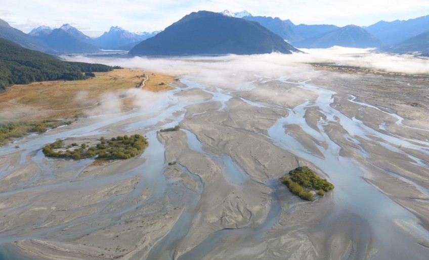
The Otago Regional Council has released the next study in its adaptation programme for the Dart-Rees rivers floodplain areas; which are subject to flooding, erosion and liquefaction hazards.
The report, Dart-Rees Floodplain Adaption, by consultants Damwatch Engineering Ltd identifies a range of potential interventions to manage flood related natural hazards in the area at the head of Lake Whakatipu.
Liquefaction, lateral spreading and flooding investigations published earlier this year from two ORC-commissioned studies confirmed that a moderate to major earthquake or flooding event in Glenorchy could have severe impacts on the town.
ORC’s Natural Hazards Analyst Tim van Woerden says that these findings provide a much better understanding of the area’s natural hazards, and enable further studies, such as this report, to understand the potential pathways for the community.
“This Damwatch report identifies a range of potential hazard management interventions and reviews the benefits and constraints of those approaches,” he says.
“It is an information resource. It offers expert analyses on a range of engineering or river management interventions rather than a set of decisions or recommendations for a specific action.”
Some of the options identified were suggestions put forward by the community in previous workshops the ORC held.
“Our next step is to further the discussion alongside the community and Queenstown Lakes District Council. There are more assessments to come,” he says.
Mr van Woerden says the report focusses on three areas with floodplain hazards, which could impact on the community or infrastructure.
At the lower Rees River and Glenorchy township the flood hazard is to residential and commercial activities, in the Dart River floodplain and Kinloch area the key issue is roading access, as it is for the Rees floodplain and the Rees bridge area, which could also have added effects on rural activities.
The effects of major floods and erosion pose risks to commercial, residential and rural properties, as well as access issues, if there were damage to roading and bridge infrastructure.
For each of the three focus areas, the report includes tables discussing the engineering or river management interventions identified as possible ways to manage the floodplain hazards.
“As well as a summary of the potential intervention approaches, the tables list the key constraints which may be challenges to implementing that type of intervention,” Mr van Woerden says.
“Our role now is to get into the detail of these reports and check the viability of some of the identified interventions, and ask the community what they think,” he says.
“But ultimately, we can’t avoid the risks of flooding and while some interventions may limit the impact of flooding, the approach has to be a long-term, all-encompassing one that looks at all the factors.”
Residents and property owners are encouraged to comment on whether the report may have missed anything, to clarify any of the information, give an opinion on the assessments and consider which mitigation approach should be further considered. Feedback on this report is welcomed, at [email protected]
As part of this next step to identify and review management options, ORC has commissioned a similar consultant assessment of possible hazard management approaches for liquefaction and lateral spreading hazards. This is underway and expected to be available early in 2023.


