GPS directing rentals down dangerous Arrowtown trail
Two-wheel drive cars and campervans have been spotted on Arrowtown's river crossing Tobins Track road, with no signage to warn the drivers it is four-wheel-drive only.
Local residents say it is GPS navigation tools that are directing visitors down the steep route, that runs off the Crown Range and drops into the township passing through the Arrow River on the way.
However the Queenstown Lakes District Council, responsible for the road, says it is working on better communicating the dangers to users and has ordered new road signs to help.
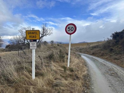
'Gravel road' is all drivers are told before their descent on the narrow, rocky, four-wheel-drive-only path.
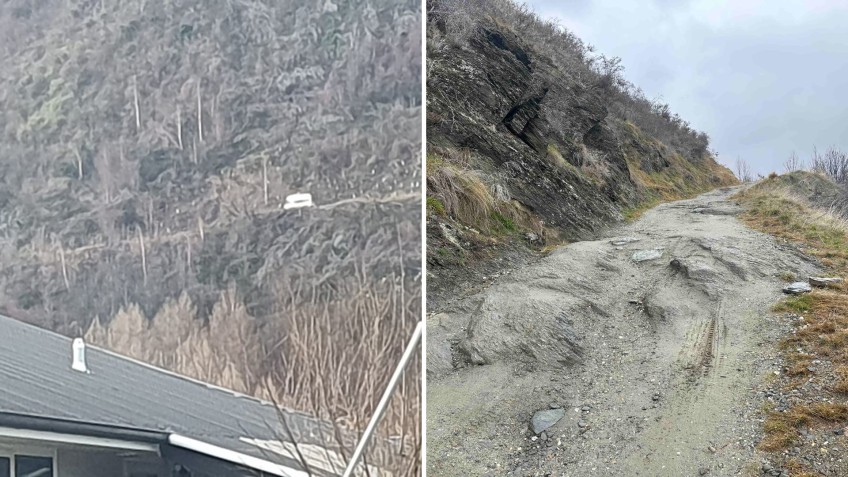
Yesterday, a local Arrowtown Facebook page was busy with commenters after a photo was posted of a campervan driving down the track.
It is not the first time inappropriate vehicles have been spotted on the route.
Arrowtown resident Marian Hamilton was driving Tobins Track last Tuesday (July 18) and saw a truck towing a rental vehicle across the river crossing.
She says the car - a Toyota Prius or similar - was driven by three Australian men in their 20s, who were directed that way travelling to Arrowtown from the Crown Range.
Ms Hamilton says the visitors had their wits about them, but “there’s just no telling what the tracks going to be like” at the start of the descent, especially without any signage.
She says she spoke with one of them, who told her the track had been “very difficult to drive down” in their small vehicle.
Ms Hamilton believes there should be signs to warn drivers about the state of the track and the river crossing - the top end of the track is 2.3 kilometres from the river crossing, and there is currently only signage at the bottom warning of the water ahead.
Another Arrowtown resident told Crux they’d saved two young tourists in “a little yellow hatchback”, who became stuck on Tobins Track last year, similarly directed by a navigation tool.
“They got halfway down the track and the road was getting really rough. They couldn't turn back and couldn't go forward.
“I managed to turn the car around but the road was narrow with a steep drop-off on one side, so it wasn't easy. Could easily imagine some inexperienced tourist going off the side or trying a river crossing when it is too deep.”
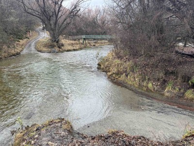
The Tobins Track river-crossing is unsafe for 'anything but a 4WD', says a Queenstown four-wheel drive expert.
Owner of four-wheel drive tour operator Nomads Safaris David Gatward-Ferguson says the unsealed road and required river-crossing "wouldn't be good for anything but a four-wheel drive".
The flow of the river could easily sweep a car offtrack, Mr Gatward-Ferguson says.
Arrowtown-Kawarau Ward Councillor Craig 'Ferg' Ferguson hasn’t heard of tourist vehicles attempting the Tobins Track but says it’s “clearly not acceptable”.
“Surely in the day of modern technology, GPS should be giving out the correct info.”
Councillor Ferguson says if signage is required then it should be fast-tracked.
A QLDC spokesperson says it has been approached by members of the public concerned about use of the track and its roading team is investigating navigation routes and has ordered additional signage.
It will state ‘4WD access only’ and be installed approximately two kilometres before the river.
"Whilst road conditions and the ability of each driver will vary we do not recommend driving this road in campervans," the spokesperson says.
"We also recommend drivers of rental vehicles in general check the terms and conditions of their hire, and also talk with their rental company at the outset about local road conditions and routes that may not be suitable for their specific vehicle."
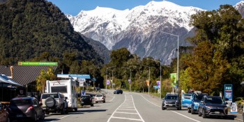
Main images: A campervan, left, spotted on Tobins Track and posted to social media. Arrowtown's Marian Hamilton says the track 'deteriorates quickly' and is quite rocky, but drivers would have no way of knowing this at the top of the descent.


