ORC report shows Glenorchy's on shaky ground, must adapt
 Share
Share
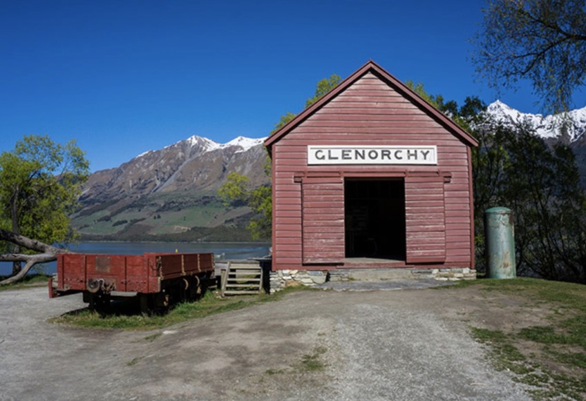
Glenorchy at the head of Lake Whakatipu sits in dramatic surrounds, now new research commissioned by the regional council confirms the location is as potentially risky as it is beautiful.
Evidence from the two Otago Regional Council-commissioned studies shows a moderate to major earthquake or flooding event in Glenorchy could have severe impacts on people, town infrastructure and properties.
It's hoped the new detailed assessments of liquefaction and flooding scenarios will help the community and local authorities develop a phased "adaptation plan" to work towards preparing for and mitigating the hazards.
In a report to be presented at an ORC committee meeting in Cromwell tomorrow, geo-technical consultants Tonkin + Taylor detail that underneath Glenorchy township there is a thick sequence of delta and alluvial sediments, with most sediments highly susceptible to liquefaction.
Liquefaction and lateral spreading occur with strong ground-shaking in earthquakes, as seen in the Christchurch earthquakes more than a decade ago.
Chair of the council’s Data and Information Committee councillor Alexa Forbes says the new information may be a source of concern for some members of the community, and she anticipates people may have plenty of questions in the weeks ahead.
“Our approach is to build and maintain the best information we can and to make sure the community is fully informed."
An online briefing was held for Glenorchy last Thursday night to reveal the new findings.
"Last week’s online community meeting was to present the latest evidence. We will have another meeting – in person – at a later date to ensure the channels are wide open for questions in the days, weeks and months ahead,” Cr Forbes says.
“Our aim is to stand alongside the community and help build resilience. The first step is communicating information. That’s happened, and now we move further into the adaptation cycle.
“We encourage people to ask questions and make contact. We won’t always know the answer straight away, but we will seek those answers out.
"Much of this is new to us too."

Time to adapt: A report to be presented to an Otago Regional Council committee meeting tomorrow outlines what's at stake for Glenorchy if a large earthquake or flood strikes.
ORC general manager of operations Dr Gavin Palmer says the latest investigations contribute to a "significant advance in natural hazards understanding".
They include the most detailed hydraulic modelling study ever taken of the Dart and Rees Rivers, and the first liquefaction hazard assessment for Glenorchy based on comprehensive subsurface geotechnical data, he says.
“The ongoing work of our natural hazards team and consultants in Glenorchy is designed to inform how residents and local government act together to adapt and plan for flooding, liquefaction and other natural hazards, informing future decision-making in the Dart-Rees floodplain and Glenorchy township.”
The ORC, in collaboration with project partners including the Queenstown Lakes District Council, is leading the programme of work to develop a natural hazard adaptation strategy for Glenorchy and surrounds.
Included on the agenda: Civil Defence capabilities, potential flood mitigations, and future town planning – all to be part of a strategy developed in collaboration with the community.
Results of the latest investigations
Previous reports have shown a likelihood of liquefaction occurring in Glenorchy during a large earthquake. Flooding has also affected houses in the township on several occasions, most recently in November 1999 and in February 2020.
However, these hazards and their likely impacts can now be better understood following the latest investigations.
The paper to be presented at the ORC Data and Information Committee tomorrow says the new technical reports build understanding of natural hazard characteristics.
The paper also reinforces the need to adapt to the new challenges and supports the public dissemination of the technical reports.
The liquefaction vulnerability report presents the assessment of liquefaction and lateral spreading impacts for a range of earthquake shaking scenarios – including an Alpine Fault rupture – when widespread "high to severe" liquefaction damage is likely across the majority of the lake-side township.
In the western parts of the town, nearer the lakefront, lateral spreading is also expected to cause major damage and vertical subsidence.
“The hazard posed by the Alpine Fault is extremely high over the next 50 years. So the likelihood of a severe level of liquefaction damage, including severe damage from lateral spreading in the western side of Glenorchy occurring in the next 50 years is very high,” the Tonkin + Taylor report says.
The liquefaction and lateral spreading impacts in Glenorchy may be comparable or worse than the most affected areas of Christchurch during the events of the 2010-2011 earthquake sequence.
For comparison, in Glenorchy there is a greater cumulative thickness of liquefiable sediments, and a much higher drop - 25 metres - into Lake Whakatipu, which is a key factor in lateral spreading susceptibility.
Parts of the township already have a relatively high flooding risk, and the vertical subsidence effects from liquefaction and lateral spreading would also increase the extent of land exposed to potential flooding.
This effect was also observed in Christchurch alongside the Avon River.
Consultants Land River Sea Consulting Ltd (LRS) also assessed the flood hazard for the Dart-Rees floodplain and Glenorchy township using detailed hydraulic modelling for a range of large-magnitude flooding scenarios. Model scenarios also looked at the effects of climate change on river flows, and of changes to the river channel alignment in the lower Rees River.
For the largest modelled flooding scenarios – events with a one percent likelihood of occurrence in any year – hazard assessments based on floodwater depths and velocities shows the worst flooding within the township may be unsafe for vehicles and people, and buildings may be vulnerable to structural damage.
Model results also show large sections of Kinloch Road, and parts of the Glenorchy-Routeburn road at the foot of Mount Alfred, would be inundated during large flood events.


TOP STORIES