South Island: still only 16 out of 71 electorates in spite of 7% population growth
 Share
Share
The North Island will lose an electorate seat as part of a sweep of new electorate boundaries and names across the country announced on Friday.
However, due to the way the current law is written, the South Island won't gain a new electorate and keeps just 16, compared to 48 in the North Island. Instead all electorates will have bigger populations as nationally they have to have the same proportionate number of voters. Parliament is not affected either as list members are not linked to electorates.
The independent Representation Commission has confirmed the final boundary changes to electorates ahead of next year's general election.
The boundary changes are largely in Auckland, Bay of Plenty, Christchurch and the lower North Island.
The changes includes having one fewer electorate in the lower North Island to account for seven percent population growth in the South Island - which by law can only have 16 seats. Ōtaki, Mana and Ōhāriu, are reconfigured into two electorates, Kapiti and Kenepuru.
Nineteen electorates are unchanged, and the boundaries of 49 general and three Māori electorates have been adjusted.
It affects about 20 percent of people in the North island, about three percent of people in the South Island, and 0.6 percent of those in the Māori electorates.
The number of Māori seats were unchanged.
There were 717 written submissions on the proposed boundaries and public hearings were held in June.
Representation Commission chair Judge Kevin Kelly - the independent body responsible for reviewing electorate boundaries said the public's contributions were "invaluable" and he was heartened so many people took an interest.
Auckland Region boundaries. Photo: Electoral Commission
"Most of the boundary changes were signalled in the proposed electorates report published in March 2025, but we have made some amendments to those proposals following public consultation," Kelly said.
As a result of submissions, there are four more electorate name changes. The proposed electorate name Rānui becomes Henderson. East Coast becomes East Cape, Wellington Central becomes Wellington North, and Rongotai becomes Wellington Bays.
Amendments include the following, from north to south.
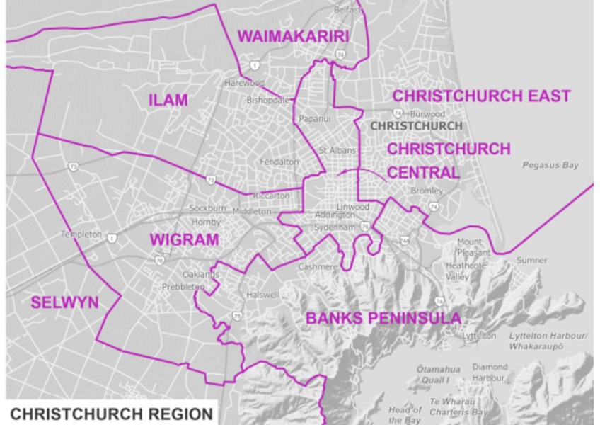
An area around Balmoral remains in Epsom rather than being moved to Mt Albert. Part of Arch Hill is moved from Auckland Central to Mt Albert. An area south of Tauranga city in the lower Kaimai Range no longer shifts into Rotorua and instead remains within Tauranga. There are related minor changes to the boundaries between Mt Maunganui and Rotorua. Proposed boundary changes north of Gisborne will no longer proceed. Instead, Napier gains several rural areas from Tukituki. Redwood remains with Christchurch Central, and instead Christchurch East gains an area from Christchurch Central in Linwood and Phillipstown.
In the Māori electorates, the boundary change between Te Tai Tonga and Ikaroa-Rāwhiti is confirmed and a minor technical adjustment is made to the boundary between Te Tai Tonga and Te Tai Hauāuru.
The final electorate boundaries and names will be used for the next general election. Any by-elections held before that election will be conducted using the 2020 electorate boundaries.
Find the final boundary maps here.


TOP STORIES