Polar blast ahead as forecaster warns of 'spring rollercoaster' weather
 Share
Share
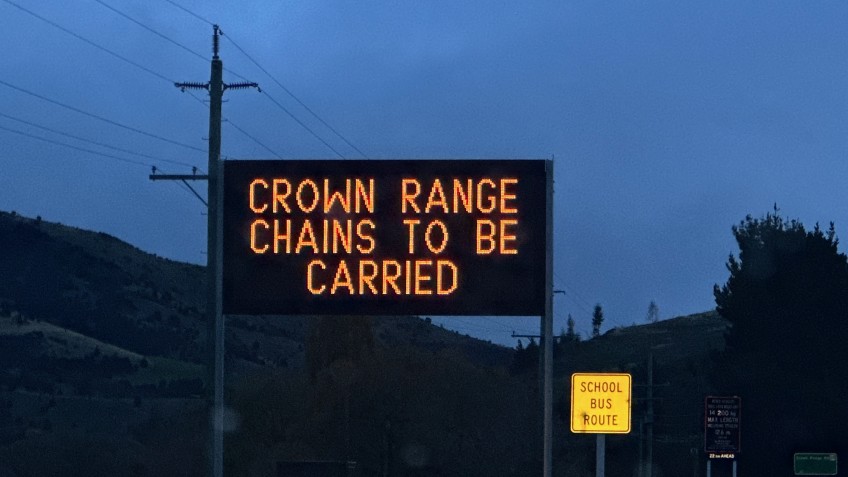
Motorists heading over the Crown Range tomorrow night (Thursday) are advised to carry chains as MetService issues several snow warnings for the south in the coming days.
A short, sharp cold snap is expected to interrupt otherwise spring conditions, potentially bringing snow showers to much of the lower South Island.
Snow is forecast to fall from 9pm on Thursday, with between one and three centimetres of snow expected to settle on the road.
Similar conditions are forecast for the Lindis Pass on State Highway 8, while up to 20 centimetres of snow could fall on the Milford Road (State Highway 94).
MetService has issued a heavy snow watch for Central Otago and Southern Lakes, in addition to Fiordland, Southland, Clutha, and Dunedin.
It says snow is expected to lower to near sea level, with heavy falls possible above 300 metres, where amounts may approach warning criteria.
The warning is from Thursday afternoon through to mid-morning Friday.
The MetService is also warning of strong northwest winds throughout Otago from this evening (Wednesday), approaching severe gale force in exposed places.
In Central Otago and Southern Lakes winds are expected to ease around dawn tomorrow (Thursday).
There is a heavy rain warning for the headwaters of Otago lakes and rivers for 11 hours from 8pm tonight (Wednesday), with waterways expected to rise rapidly, and surface flooding and slips possible.
NIWA says the presence of El Niño makes dramatic temperature swings even more likely than usual over the next few months.
MetService weather warnings can be found online here.
Main image: Snow is expected to settle on the Crown Range road throughout Thursday (October 26) night.
![]()


TOP STORIES