ORC - if it stops raining, lakes will take 19 days to drop
 Share
Share
Here's the latest comprehensive update from the Otago Regional Council.
A MetService heavy rain warning is now in effect until 9am Saturday, with a further warning likely to be issued for Saturday and Sunday.
ORC modelling based on past events predicts that both Lake Wakatipu and Lake Wanaka will take around 19 days without further rain to return to average December levels (310.2m and 277.6m respectively). This does not mean the lakes will be in flood for 19 days, but is an indicator that lake levels will be high, and consequently river flows will be elevated, for several weeks.
To return to normal levels, Lake Wanaka will need to drop more than 3m, and Lake Wakatipu a little over 1.2m. Coincidentally, given the different capacities and outflow rates of each lake, they will take roughly the same amount of time to decrease to normal levels.
Lake Wanaka
At 12pm, Lake Wanaka was at 280.07m.
ORC is now moderately confident that Lake Wanaka will reach a higher level than previously forecast, as MetService have increased confidence in higher intensity rainfall today and overnight.
The previous expectation was for Lake Wanaka to reach 280.3 – 280.5m. The latest modelling predicts Lake Wanaka could reach a level of 280.5 – 280.8m by the end of the weekend or Monday morning. This prediction does not consider the impact of wave levels due to wind.
This level is above the January 2013 peak (279.4m), but well short of the November 1999 peak (281.3m). However, lake levels and river flows will continue to be high for some weeks, meaning there is a continued risk of further flooding there should be more prolonged heavy rainfall.
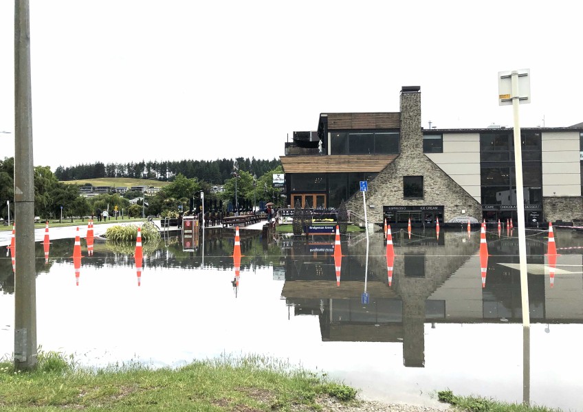
Lake Wakatipu
At 12:05pm, Lake Wakatipu was at 311.17m.

The steps that used to lead down to the Queenstown lake front beach - at 12 noon on Friday December 6.
Our prediction for Lake Wakatipu is largely unchanged from yesterday. The lake is expected to reach 311.4m by Monday morning, not accounting for wind. This lake level for Wakatipu is still well short of historic flood levels such as the November 1999 event (312.8m) and May 2010 event (311.48m).
Downstream River Flows
Overnight downstream flows were not as high as expected, as the outflow from Roxburgh briefly decreased to 1820cumecs (cubic metres per second), after peaking at 1950cumecs.
The Clutha / Mata-Au River flow at Balclutha is expected to increase during the day, and to now reach 2000cumecs later on Saturday. The river is expected to be well contained within flood banks.
People operating in the vicinity of the Clutha / Mata-Au river in the coming days need to be aware of the possibility that the river level may rise rapidly because of high rainfall in the headwaters, regardless of the local weather.
ORC has set up a dedicated webpage for this event (www.orc.govt.nz/cluthaflowsdec19) with links to up-to-date lake levels and flows, elevation maps for affected areas, and further resources.


TOP STORIES