Mother horrified council camera captured real-time images of kids in backyard
An error has resulted in images of children playing in a Wānaka backyard being available for public viewing on a new app being used by the Queenstown Lakes District Council for environmental monitoring.
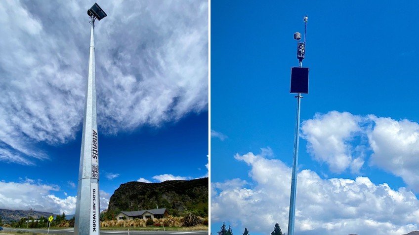
Tatiana Elvery says one of the "massive, shiny" poles erected by the council is mounted right outside the fence of a property belonging to her parents-in-law, and a camera atop it sees everything.
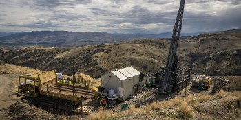
The 8.5-metre poles house environmental sensor units that, according to the council, will be used to monitor weather conditions, air quality and wildfire risk.
This summer the council has installed ten of them in the district, close to Ben Lomond Recreation Reserve in Queenstown and Mount Iron Recreation Reserve in Wānaka.
Ms Elvery says she discovered both still and timelapse images captured by the units of her children running around outside at their grandparents place in close-to realtime on a connected app.
There was no prior discussion with her parents-in-law before the offending pole was erected, and Ms Elvery thinks it is it is "absolutely unacceptable that people's backyards are being monitored without prior consent".
She says the images have since been taken down, but before they were she was able to watch timelapse footage with just a 30 minute delay, taken from 6am until 6pm.
"For example, if I watched the timelapse at 12.20pm, I could see 6am to 11.50am, but if I watched at 8pm, I could see 6am to 6pm."
The council has admitted to a teething error as the units have been trialled.
QLDC resilience and climate action manager Bill Nicoll says, "The data showing private residences during the pre-launch testing period is regrettable as it was not intended for public access".
The project is in collaboration with Spark New Zealand and Australian technology firm Attentis, with input from Fire and Emergency New Zealand and Emergency Management Otago.
Included up the poles are visual and thermal imaging equipment, with real-time transmission of information captured available via an app from Attentis.
According to the council, monitoring environmental conditions in this way is one step the community can take towards learning how to adapt and build resilience in the face of changing weather patterns.
Mr Nicoll says a 'Privacy Impact Assessment' will be undertaken before the system officially "goes live", and it is his intention the final set-up will only allow for data feeds relating to council reserve land to be shown.
"Privacy considerations are a priority for the council."
Meanwhile information on the new units on the council's website says whilst they can take photos this is done from a "high angle and distance".
"This feature will not be available in sensors which are directed towards urban communities," the website information says.
This is a requirement of the council's CCTV policy, which says, "All due care must be taken to ensure CCTV systems operated by QLDC do not capture images from private dwellings".
According to the policy, areas where cameras are installed must also be clearly signposted, and any images captured generally erased within 90 days and able to be viewed only by authorised personnel.
Wānaka councillor Quentin Smith has been in contact with Ms Elvery, and has taken her concerns to council staff.
He says it is clear in this instance the council was not following its own rules, but stresses the technology is still in its early days of operation and the issues will be "ironed out".
"We'll work through it."
A map showing the location of all ten environmental sensor units, plus more information about them, is available on a page on the council's website.


