MetService says heavy snow on the way for Wednesday
 Share
Share
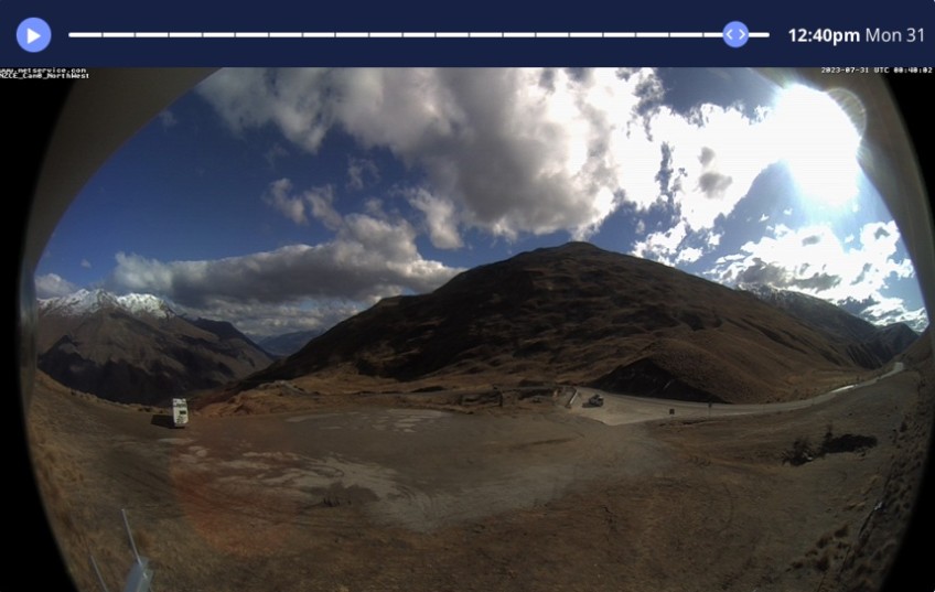
While the hills are looking more brown than white in many spots, a series of fronts begin spreading up the country from today (Monday), with MetService forecasting a decent dump of snow in the days ahead.
A heavy snow watch has this morning been issued for Queenstown Lakes, Central Otago and inland parts of Dunedin starting late tomorrow night (Tuesday).
Snow is forecast to lower to 300 metres by early Wednesday morning and will be heavy above 500 metres, potentially approaching warning criteria.
Snow flurries may continue throughout the day, with the cold front predicted to have moved through by Wednesday evening.
Motorists are advised snow may settle on the Lindis Pass and Crown Range roads above 800 metres from tomorrow afternoon (Tuesday), with further dumps over the following 12 hours also likely to impact the roads.
There is also a warning inland Otago will experience strong winds as the fronts approach, with Met Service saying winds may reach sever gale force in exposed places from Tuesday evening through to Wednesday morning.
Main image: The traffic camera on the Crown Range shows more desert, less winter wonderland today, but MetService is predicting that to change in the the coming days.
![]()


TOP STORIES