Council backs 51km Coronet Peak trail network
 Share
Share
A plan is in motion for a network of trails to crisscross a block of public land the size of at least 320 football fields on the lower slopes of Coronet Peak close to Arrowtown.
And, newly established local nonprofit Tāhuna Ride and Conservation (TRAC) has committed to providing half of the estimated $1.5 million needed to see the recreational area developed.
The Draft Coronet Trail Network Plan was adopted by members of the Queenstown Lakes District Council's Community and Services on Tuesday - subject to staff reporting on staging and funding options.
The plan maps out 51 kilometres of proposed tracks - specifically catering to horse riders, mountain bikers, and walkers - on land the council has cleared of Douglas fir trees and will replant with natives.
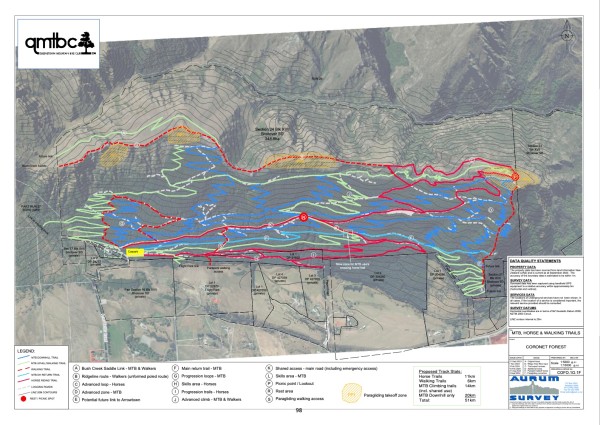
A network of trails is planned for a new forest on Coronet Peak (Image: QLDC).
The first plants will go in the ground next year and planting is expected to continue for up to seven years. Similarly, the building of the trail network will also take place over time.
The council has been working alongside members of community groups with an interest in the site for several years on how to optimise recreational opportunities there.
A report by council parks manager Briana Pringle to the committee says the Coronet Forest Recreational Working Group was formed and a subgroup of "highly motivated volunteers" created the first draft plan, which has since been reviewed and refined.
Horse riders have historically used the area, when it was covered in trees, under a formal arrangement with the council, and paragliders have also accessed launch spots from the land.
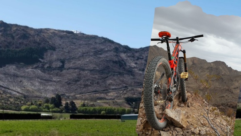
But its steep slopes appeal to mountain bikers too, and the Queenstown Mountain Biking Club has helped with developing the new plan.
Ms Pringle says the goal for those involved in the project has been "to remove the risk of conflict between users at the site and to accommodate shared use where possible".
She says the plan "is intended to provide a framework" moving forwards.
"Having a well-designed plan in place for the trail network means that QLDC can construct trails when funding opportunities present and before the site is revegetated with trees.
"Trail construction before planting means there is a greater chance plants won’t have to be moved at a later date to accommodate a trail."
Ms Pringle suggests in her report having a plan in place early enables the council to chase external funding opportunities and she thinks there will be volunteer opportunities to explore in the future with users to help develop and maintain the site.
At the meeting she revealed TRAC's funding commitment, which was made since she wrote her report, as well as the organisation's intention to help with maintenance of the trail network for five years.
Councillor Matt Wong said the flagged financial support made the draft plan more "palatable".
In a post to social media, TRAC says the council's decision is "progress in the right direction".
"This trail network is proposed within Coronet Forest, currently the largest revegetation project in Aotearoa. The inclusion of trails helps education, health and restoration activities."
In her report Ms Pringle notes commercial concessions and corporate sponsorship are other options the council can consider for the site.
Access to it is via Alan Reid Road, off Malaghans Road.
The plan is for a deer fence to be installed around the perimeter of the site to keep out pests, including goats and rabbits.


TOP STORIES