Wānaka property owners to have new flood hazard info added to their LIMs
 Share
Share
The Queenstown Lakes District Council is contacting owners of properties in Wānaka potentially at risk from flooding.
The property owners are being advised the hazard risk details will be added to their property's Land Information Memorandum or LIM.
There's been some fresh flood modelling done to inform the decision.
The modelling, which has been carried out in Wānaka and Albert Town for now, will continue across the district, and helps predict what may happen in extreme rain events.
In a media statement this afternoon, QLDC strategy and asset planning manager Mark Baker says it's about allowing the council and the community to prepare for these events.
“The modelling has been completed to better understand the flood hazard in the district. The maps will inform our stormwater investment programme and help the community to understand possible flood risk in their area and for their property."
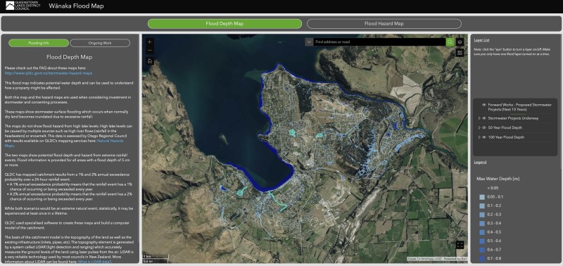
New maps from the QLDC are identifying flood hazards on private property.
The maps are publicly available online using a GIS map tool. Residents and property owners can zoom in on any property and identify the potential flood risk.
Two maps have been produced based on the same modelling results - One map indicates possible water depth caused by stormwater flooding; the other indicates any potential hazard affecting people, property or vehicles, and is based on a combination of water depth and velocity.
The maps have been created using a computer model that calculates how, when and where rainwater flows, accounting for climate change, local topography and stormwater drainage such as pipes, basins, creeks, bridges, culverts and soak pits. Environmental factors such as soil characteristics and where rainwater moves slowly or soaks into the ground are also factored into the model.
The council has sent letters to property owners in the Wānaka and Albert Town assessment areas advising them about the potential hazard information being added to their LIM.
“Property owners don’t need to take any specific action as a result of this modelling. However, we do recommend they take a look at the maps and understand any potential risk, especially if they have plans to subdivide or build. This new information will be used to inform consent processes and our consent officers will be able to provide advice for each specific situation as it will depend on the property and proposal."
The modelling will help the council make decisions about where it spends money on stormwater improvements, he says.
“Currently we have multiple stormwater projects underway in Wānaka and across the district. These include the upgrades taking place at Stone Street, Bullock Creek, Aubrey Road, Rata Street and Anderson Road. Work ranges from pipe upgrades to new soakage pits, a stormwater detention facility and stormwater flow diversion and treatment."
There's also budget earmarked in the council's ten-year plan to investigate what further investment may be needed.
Similar assessments are being completed for all townships across the district and are due to be released later this year, through to 2024, the council statement says.
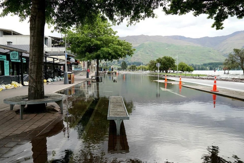
Main image (Facebook/Jordanah Cullen): A flooded Wānaka in 2019.


TOP STORIES