Some flooding on the way - downstream residents told to boil water
 Share
Share
Here is today's comprehensive flooding update from the Otago Regional Council.
A MetService weather watch is in place for heavy rainfall in the Otago headwaters. Reasonably high intensity rain is also expected from morning to evening on Friday, but not as heavy as experienced earlier this week.
With the current MetService rainfall forecast, lake levels will continue to slowly rise this evening and in the coming days.
The outlook after the weekend is currently looking brighter, with no heavy rain expected. However, the lakes are at very high levels and may take several weeks to return to normal levels, and river flows downstream are also increasing.
ORC will be modelling the recession of lake levels, to predict how the lakes may respond to reduced inflows next week. This will give us an indication of how long the lakes may be at risk of elevated levels.
There is no longer a strong wind watch in place for Otago, but wave action is still possible on the lakes, and debris will remain a factor.
Lake Wanaka
At 3pm today, Lake Wanaka was at 279.97m. ORC modelling estimates that Lake Wanaka will reach a level of 280.3-280.5m by late in the weekend. Inundation of the lakeside Ardmore St can occur at 280.0m. There is a low confidence prediction, meaning a slim chance, that the level could reach 280.7m.
This level is above the January 2013 peak (279.4m), but well short of the November 1999 peak (281.3m). However, lake levels and river flows will continue to be high for some weeks, meaning there is a continued risk of further flooding.
The attached map shows what parts of Wanaka are susceptible to flooding at different lake levels.

ORC's water level forecast for Wanaka
Lake Wakatipu
At 3pm today, Lake Wakatipu was at 311.20m. ORC now estimates that Lake Wakatipu will reach a level of 311.4m by Sunday afternoon, which is 0.1m above the level where flooding of the Queenstown stormwater system is a possibility. The lake begins to overtop into lower lying parts of the Glenorchy Waterfront Reserve at a level of 311m.
This lake level for Wakatipu is still well short of historic flood levels such as the November 1999 event (312.8m) and May 2010 event (311.48m).
The attached maps show what parts of Queenstown Bay and Glenorchy are susceptible to flooding at different lake levels.

ORC's water level forecast for Queenstown

ORC's water level forecast for Glenorchy
Downstream River Flows
The focus of ORC’s monitoring is extending throughout the full catchment as water moves downstream. The sequence of rain events and duration of high water and flow levels will continue to pose a risk throughout the catchment.

The Clyde Dam today - spilling as much water as possible from upstream. Image: Carol Gardener
Contact Energy has increased the outflows from the Roxburgh dam to 1950cumecs (cubic metres per second).

The Roxburgh dam today. Image: Tony Smith.

The Clutha River at Alexandra - could be running high for weeks. Image: CODC.
Flows in the vicinity of Alexandra are rising in response to upstream flows, but we expect the flows to be contained within the river.
The Lindis and Manuherekia rivers have also experienced significant rises from rainfall on the northern Otago boundary.
Flow at Balclutha is rising and expected to pass 2000cumecs by this evening. ORC’s engineering team is monitoring flows at Balclutha and the Clutha River mouth to ensure the water is able to flow out to the sea unobstructed.
People operating in the vicinity of the Clutha / Mata-Au river in the coming days need to be aware of the possibility that the river level may rise rapidly because of high rainfall in the headwaters, regardless of the local weather. Local authorities (Central Otago and Clutha District Councils) will be sharing information on their social media and website pages.
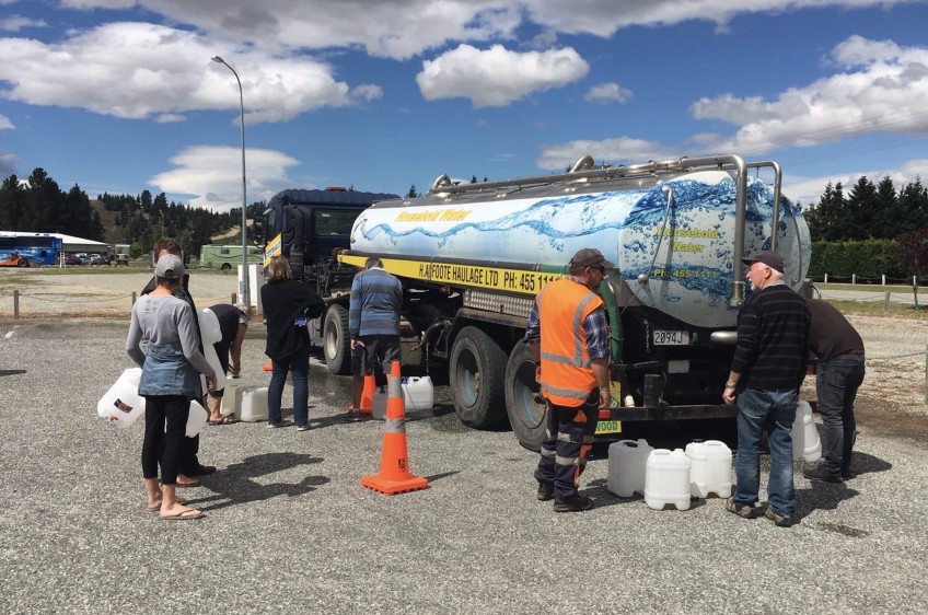
CODC have a boil water notice in effect for the Alexandra, Roxburgh and Lake Roxburgh Village town water supplies, and are asking residents to conserve water.
Main Image: A fresh water tanker in Alexandra. Image: CODC.


TOP STORIES