Jacks Point cycle trail delayed by new bridge cost
The new Jacks Point to Frankton walking and biking track has hit a stumbling block as engineers have discovered a costly issue with plans to build a bridge over the Kawarau river.
It relates to the land where the foundations for the proposed bridge over the river are to be placed.
Waka Kotahi Otago regional relationships manager James Caygill says “poor soil conditions” have been identified during detailed geotechnical investigations.
And the discovery’s not good for the project’s bottom line.
Although central government funding is ready and waiting for both the design and construction of the much-anticipated active transport route, this construction blowout isn’t in the budget.
“The latest tests highlight the cost of the new bridge over the Kawarau River will be significantly more expensive than anticipated due to ground conditions in the area, which means Waka Kotahi will need to apply for more funding to complete the works,” Mr Caygill says.
“In the interim, all other elements are being worked on to ensure the project is shovel ready once funds are available.”
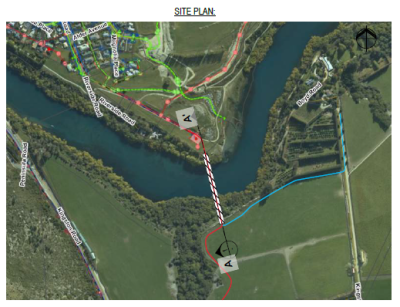
A new bridge to deliver cyclists and pedestrians over the Kawarau River and into Frankton by Remarkables Park has met unexpected costs (Image Waka Kotahi).
Initial groundwork was completed by geotechnical engineers in 2020, followed up with further investigations at the site last August. A report was then provided to Waka Kotahi, delivering the disappointing news, in December.
Exactly how much more “significantly more expensive” is remains unknown.
“We are not able to provide further detail on the estimated costings at this stage,” Mr Caygill says.
It’s frustratingly slow progress for cycling commuters living in both Jacks Point and Hanleys Farm, who are desperate for a safe dedicated route into Frankton.
Plus, with Otago Regional Council-contracted bus operator Ritchies struggling to recruit drivers, near-constant bus cancellations in the area mean there’s no alternative for locals keen to ditch private vehicles to get around.
There’s already a more meandering, steeper, scenic lakeside route from Jack’s Point to Kelvin Heights and on to Frankton.
But the new route – called the “A7” in planning documents – is far more direct, shooting down the valley, before dropping under the highway and crossing the Kawarau a little upstream from Boyd Road.
It will funnel commuters to Wakatipu High School and the ever-growing industrial, commercial and retail hubs at Frankton.
Queenstown Trails Trust chief executive Mark Williams says the communities in these southern satellite suburbs are ready and waiting for this sort of infrastructure.
“There’s a big section of that community that are super keen to ride to work and then, obviously, you’ve got the kids being able to ride to the high school too.”
“I get a call probably every other day from either the Jack’s Point or Hanleys Farm community asking when this trail is going to be in.”
The six-kilometre-or-so route’s a no-brainer – it suits not just commuters but also recreational cyclists keen to create a loop with the section of the Queenstown Trail from Kelvin Heights to Jack’s Point that hugs the lake.
“It would probably be a 10 or 15-minute ride, tops, from Jack point…And e-bikes, obviously quicker again…It’s actually a really short trip as the crow flies.”
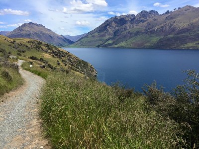
People can jump on a bike and ride a trail from Jacks Point to Kelvin Heights, and on to Frankton, but it's a scenic route, rather than a direct one (Image Facebook).
Mr Williams says it’s been on the trust’s radar for years, but the trust's no longer driving the project.
It’s fallen to Waka Kotahi, as part of its Way to Go partnership with the Otago Regional Council and the Queenstown Lakes District Council.
The goal: to relieve mounting pressure on the transport agency's highway network in and around Queenstown by offering people real alternatives to travel by private vehicle.
Mr Williams says the trust, like the rest of the community, wants to see the trail up and running “sooner rather than later” and will continue to lobby and work with Waka Kotahi to see it happen.
“It has been a bit disappointing that it’s taken this long. The wheels of bureaucracy have turned pretty slowly on this. This trail should have been in by now.
“At the moment people are taking their lives in their hands when they ride along the state highway.”
Mr Caygill says the exact route of the path is still up in the air as parts of it will need to go through private property.
Nutting out the particulars of these arrangements is still ongoing.
Also in the conversation is the QLDC, who is working with Waka Kotahi and developers to ensure the decided-upon route connects with existing and future communities in the area.
“A number of routes were considered as part of the business case, including one adjacent but separate from the highway, and one via farmland on the lake side of the road. Both routes would connect from the existing Jack’s Point trail to the south and to the Frankton Trail,” Mr Caygill says.
“However, we have not been able to secure a preferred line for the routes’ entirety with land owners and discussions are ongoing.”
In general, all the landowners are “supportive of the active travel network on their land”, he says.
Jacks Point resident Kerry Williams is frustrated he and his neighbours can't jump on a bike and cycle into town, especially with ongoing bus cancellations in the area.
He says cycling on the highway isn’t a good option, although there are those who do.
“You’d be foolish, and I’ve tried it…It’s so dangerous.”
He thinks it’s “ludicrous” the project’s taking so long, especially as it was identified as a priority piece of the active transport puzzle for the district years ago.
The Queenstown Trail Trust is successfully delivering a growing network of biking and walking trails in the district, and Mr Williams reckons it'd get this job done pretty quickly too, if it was still on its plate.
He also wonders why some forward thinking didn’t ensure easements for a transport link like this were secured much earlier, at the same time as easements for underground wastewater pipes to new settlements on the southern side of town were secured, for example.
“At the time, when they organised the easement with the landowners, why in heavens name didn’t talk about a transport easement upstairs, above ground?”
Meanwhile, the Arthurs Point to Queenstown active transport link - known as route C5 in planning documents - has in recent months received a funding injection to move it forward.
A little more than $10 million has been approved by Waka Kotahi for the route, which has now been designed in detail and consented.
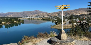
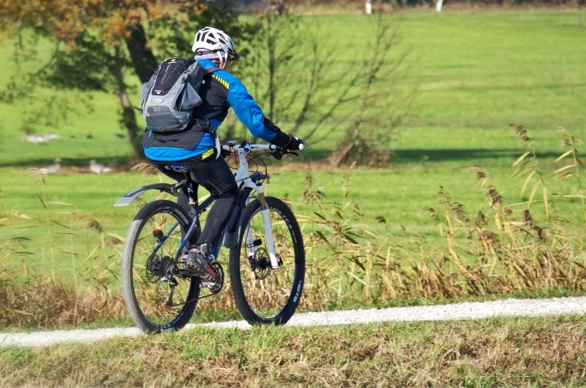
Main image (Pixabay).


