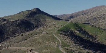
Cromwell: The town that was sold a lake
 Share
Share

Karleigh Hoera, a trustee for Guardians of Lake Dunstan: The trade-off was that we would get this amazing lake. It was short-lived.
From her home perched on McKellar Court, Cromwell lawyer Karleigh Hoera is watching Lake Dunstan disappear.
She looks down onto the Butcher’s Drive boat ramp, where she and the family used to launch their boat for a blatt on the lake.
There’s now so much silt there, it’s impossible to get a boat in and out.
She says a few boaties, engines sitting higher in the water, continued to give it a crack for a bit, but even they’ve given up trying.
“That boat ramp used to be full of cars over summer, and now it’s unusable.
“And, you can’t even really swim there, because the silt goes so far out there’s nowhere to really get in the lake.”
A short walk away, in the Cromwell Heritage Precinct, the wooden jetty juts out into barely knee-deep water, muddy silt building up around its piles.

Cromwell College pupils work with LINZ and NIWA on the lakeshore at the Cromwell Heritage Precinct in February.
On the adjacent beach, free-range kids coat themselves in glittery sludge that’s buried the river stones at the lake’s edge, pond weed dripping off their arms.
“Everyone used to bring in their boats and park up there and have a picnic. There’s a BBQ, there’s Old Cromwell. You can’t do any of that now.”
It’s like the land is “reclaiming itself”, she says.
“The lake is disappearing, and the river is coming back.”
The river is the Kawarau.
It drains Lake Wakatipu and by the time it flows under the Bannockburn Bridge on the outskirts of Cromwell the Shotover, Arrow and Nevis Rivers have emptied their contents into its flow.
Neil Gillespie, the community relations and projects manager at Contact Energy says the Shotover is the culprit of the sediment build-up in the Kawarau Arm of Lake Dunstan.
Every two years, since the lake began filling in 1992, Contact has surveyed cross sections of the lakebed in the Kawarau Arm, something it must do to fulfil resource consent obligations.
Based on these surveys, the amount of sediment accumulating in the Kawarau Arm of the lake has averaged one million cubic metres a year from 1994 to 2018.
How big is one million cubic metres? Well, it’s as much concrete as was used to build the 100-metre-high Clyde Dam, equivalent to 400 Olympic-sized swimming pools.
Over the 24 years, that’s a whopping 9,600 swimming pools-worth of fresh lakebed.
It doesn’t happen like clockwork – Mr Gillespie says the bulk of the sediment washes down during big floods, so less rain upstream in a given year means less sediment down.
Ms Hoera reckons the December flood, that saw sandbags buffering Queenstown shops and people kayaking on Wanaka streets, was the tipping point for Cromwell’s lakefront.
“It wasn’t really visible to the public, but, this year, it’s hard to miss. When the lake’s low, it’s a super-solid bank, now, stretching out.”
Sold a lake
Powers-that-be have known from the beginning there was a lifespan on the lake amenity of the Kawarau Arm.
Mr Gillespie says land reclamation now being seen in the area aligns with sediment calculations made by NIWA during the construction of the Clyde Dam.
And, based on Contact’s own ongoing modelling and data collection, what’s happening now is to be expected, he says.
The silt islands and marooned logs populating the Kawarau Arm, frustrating boaties and spoiling beaches, were always on the cards.
Harder to accept, by those sold a lake.
“The promise was, from the Ministry of Works back in the day, that we would get this amazing lake, and that would be the trade off, but it’s going to be very short-lived,” Ms Hoera says.
“They certainly always knew this was happening. I mean, locally no one thought that, but anybody that had anything to do with the engineering of the dam understood that the silt was going to build back up. That’s no surprise. But it’s definitely surprising to the general public, it’s not what people were sold.”

Guardian of Lake Dunstan Karleigh Hoera: 'The lake is disappearing, and the river is coming back.'
Ms Hoera is a trustee for Guardians of Lake Dunstan, a group of locals working to protect and enhance the lake.
Group chairman Duncan Faulkner says during community consultation this summer sediment build-up in the lake was a hot topic.
Boaties complained of not being able to launch at the Cromwell boat ramp, bottoming-out on sandbars and the danger of unexpectedly hitting one at speed; swimmers complained of no longer being able to take a dip at a favoured spot as forests of weed had sprung up on silted beaches; and walkers complained about the horrible smell from the boggy silt.
Self-appointed guardians of the “orphan” lake, the group is actively exploring options to manage the silt build-up.
Options range from routine removal to retaining walls.
But, by far the easiest and most cost-effective: letting nature take its course, Mr Faulkner says.
That’s what Contact plans to do.
Except at Bannockburn Inlet, where, same as with the lakebed surveys, there’s an obligation to manage silt as part of its resource consents.
Although, the electricity generator is looking to lighten that load.
Clearing logs

Contact's community and projects man and Central Otago District Deputy Mayor Neil Gillespie says it was always known the Kawarau Arm of Lake Dunstan would silt up.
Mr Gillespie says Contact is in discussions with the Otago Regional Council (ORC) about seeking a resource consent variation to “make sure there is a balance between ensuring the boating and swimming amenities are retained and not imposing onerous sediment removal plans that create environmental issues”.
ORC’s Byron Pretorius, who looks after compliance matters in Central Otago, says he has seen instances where the environmental impact of dredging and other sediment removal options outweighs the improved amenity, as Contact is suggesting may be the case at Bannockburn and why they are seeking a variation to current consent obligations.
For now, Mr Pretorius says Contact must provide data from five-yearly surveys of the lakebed in the Bannockburn Inlet.
Where survey data shows the lakebed to be above a set height above sea level, Contact must then remove deposited sediment from the inlet.
In addition, it must ensure a channel of a set depth and width between the flowing water of the Kawarau and the Bannockburn Inlet, and ensure sediment doesn’t impede on irrigators access to water.
Upon request, Mr Pretorius was unable to provide any detailed information on events where Contact had, in recent times, cleared the Bannockburn Inlet of sediment.
He says a report by the Lake Dunstan Harbourmaster last year shows the harbourmaster had visited the site and was satisfied boating and swimming amenities were unaffected by sediment build-up at that location.
Mr Gillespie says he’s unable to provide information of how much money Contact budgets for sediment management or how much has been spent in recent years as it is “commercially sensitive”.
In its Landscape and Visual Amenity Management Plan for the bed of the Kawarau Arm, reviewed and signed-off this year by the ORC and another requirement of its consents, Contact says only minor excavation has even been required at the Bannockburn Inlet to date.
Now up-to-date and good for the next half-decade, the plan outlines Contact will continue to keep an eye on how the bed of the Kawarau Arm changes, and will also clear driftwood from outside Old Cromwell after floods and do a dig at Bannockburn, if required based on consent conditions.
As for any action plan to improve boat or swimming access? Well, recreational amenity is “not considered expressly” within the plan.
Resource consents only require Contact to prepare a plan addressing landscape and visual amenity.
And, in its plan, Contact further downplays its responsibilities for those.
Gold mining, orcharding, and farming modified the landscape well before hydroelectricity came along, and population growth, tourism, light industry and viticulture after it, it says.
Landscape change is part and parcel of the town’s development – the pre-lake character of the Kawarau Arm was already “considerably modified”.
The changes locals are seeing in the Kawarau Arm are “relatively minor in contrast to the wider change that has and is occurring”, the plan says.

In it's action-plan for the Kawarau Arm, Contact says it will continue to clear driftwood from the lakeshore around the Cromwell Heritage Precinct, but, mostly, it will let nature take its course.
Journalist Derek Grzelewski, writing for New Zealand Geographic, says the silt deposited at Bannockburn is the tipping point which, “like a slow-moving tsunami of porridge”, will reach Cromwell in years to come.
It’s arrived.
But, at this section of the lake, downstream of its initial landing point at Bannockburn, there is no consent requirement for Contact to clear it.
It ain't pretty, but there's nothing to worry about
Jean-Luc Payan, who heads the ORC’s natural hazards team says the changing shape of the lakebed in the Kawarau Arm will only come on his radar if it poses a flooding hazard.
At present, it doesn’t. Further up the catchment, at the town of Glenorchy, Mr Payan says it’s a different story as sediment build-up has potential to cause flooding in and around the township.
Reports of boats bottoming out, grumpy want-to-be swimmers, and stinking mud in Cromwell doesn’t make the pile of work on his office desk.
Downstream, when the heavens open, Contact ‘flushes’ the dam at Roxburgh – a response to historic flooding upstream of Roxburgh in Alexandra.
At Clyde, Contact has no obligation to ‘flush’ Lake Dunstan or rid it of sediment, Mr Payan says.
There’s another authority with a hand in the management of Cromwell’s man-made lake: Land Information New Zealand (LINZ).
And, it’s LINZ that is responsible for the management of the lakebed itself.
But, LINZ group manager land and property Jeremy Barr says, although it makes decisions on lakebed use on behalf of the Crown, often in conjunction with the Department of Conservation, ORC and Contact, this responsibility “has not and does not currently extend to the management or monitoring of sediment and silt in the lake”.
Sediment build-up, he says, is a natural process that was anticipated when the lake was created.
It’s heard Cromwell’s moans and groans about its unusable boat ramp and sludged-up swimming spots, and the complaints have certainly been louder this last year.
But, removing sediment would be a fruitless task as the next big dump of rain would simply shift another load of silt in its place, Mr Barr says.
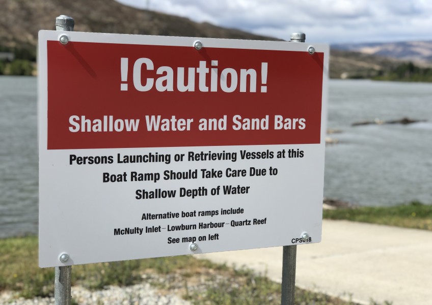
LINZ may consider closing the Cromwell boat ramp on Butcher’s Drive, but, for now, it has worked with Contact to put up signs informing lake users of water level changes due to sedimentation.

Sorry boaties, there's no plan to clear silt from the Cromwell boat ramp on Butcher's Drive.
Another issue: The build-up of sediment in the Kawarau Arm has potential to create more habitat for lagarosiphon to establish.
The invasive aquatic weed is a pet peeve for boaties, snagging fishing lures and tangling itself in boat engines.
LINZ contracts biosecurity company Boffa Miskell to fight the pest in Lake Dunstan.
When the weed is dusted in silt, diquat, the herbicide used to kill it, doesn’t stand a fighting chance.
It means in the Kawarau Arm, Boffa Miskell relies on a submerged cutting tool or a diver to try and control the pest, and both manual options still work well, Mr Barr says.
Front and centre of the Cromwell Masterplan, a document created with community input last year to steer the steadily growing town three decades into the future, is a photo taken from the Cromwell lookout of the junction of the Kawarau and Clutha/Mata-Au Rivers.
That photo of that iconic view is already out-of-date.
It’s ironic it was chosen to grace the front of a document looking to the future, Ms Hoera says.
“As our population’s growing, our lake is getting smaller. And, really, the lake is one of the main reasons why a lot of us live here. It’s what makes Cromwell beautiful. I don’t know what the town would be without the lake.”
Mr Gillespie says the lake out the front of the Cromwell Heritage Precinct will one day look similar to that upstream of the Bannockburn Bridge.

The Kawarau River upstream of the Bannockburn Bridge: Contact's vision for the lake at the Cromwell Heritage Precinct. Exactly what the landscape may look like in the process of getting there, no one can tell us.
In documents, Contact has noted many of the silt bars in the Kawarau Arm are already relatively stable, and those close to the shoreline have been quick to vegetate with grasses, willow and wetland species such as raupo.
From the lake, a wetland is emerging.
Of course, when the lake was filled, the commercial heart of Cromwell was relocated above flood line, and now sits on a peninsula jutting out with water on three sides.
So, although it’s not as convenient as the boat ramp a stone’s throw from home, Ms Hoera can drive a little further up the lake to launch her boat at McNulty or Lowburn Inlets. They’re still sweet spots to swim as well, although freedom campers can crowd out Lowburn, especially over summer.
But no one has been able to tell Crux what happens when that slow-moving porridge of silt reaches the Clutha/Mata-Au junction. Where to from there? And who’s responsible for finding out, and letting the town now what’s in store?
Ms Hoera says those with the power to do something have largely washed their hands of the affair.
“They’ve just sort of said, look, you know, that’s what’s going to happen and there’s really nothing we can do about it.
“It’s not going to go away.”


TOP STORIES