Video: "Get home...stay home": Dunedin under red rain alert
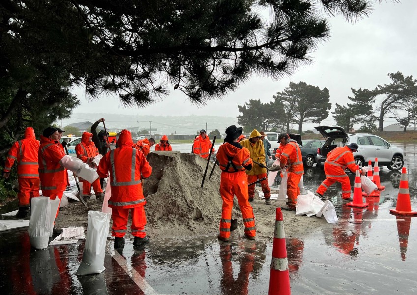
Dunedin residents advised to get home before dark in response to today’s heavy rain.
Dunedin's Civil Defence bunker was activated and sandbags handed out in the city after the MetService this morning issued a Heavy Rain Warning – Red for Dunedin as heavy rain is now forecast to continue until late on Friday evening. The Met Service says some areas may see one to two months of rain before the end of Friday.
Civil Defence Controller Rob West says driving conditions are already challenging in some areas, particularly on parts of Otago Peninsula, and people should avoid all non-essential travel tonight.
“There are significant areas of surface flooding on Peninsula Road and around Hoopers and Papanui inlets, so we’re encouraging everyone to drive to the conditions, get home before dark and stay home once they get there, if possible.”
"One slip has been reported at Papanui Inlet in the vicinity of Cape Saunders Road, and motorists in the area are being advised to exercise caution."
The prolonged rainfall is already causing some surface flooding on roads around the city and there is a risk of more, and slips in some locations, as the weather event continues.
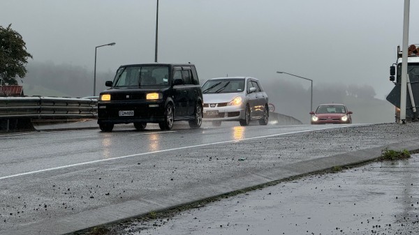
Rain is falling and forecast to continue until Friday evening in Dunedin, Thursday, October 3, 2024.
Rising river levels are also being monitored by the Otago Regional Council.
The pre-bagged sandbags are now available at the Dunedin Ice Stadium carpark, Saint Kilda and at Mosgiel Memorial Park gym carpark, a Dunedin City Council spokesperson said.
Sandbags will also be available at the Middlemarch Showgrounds.
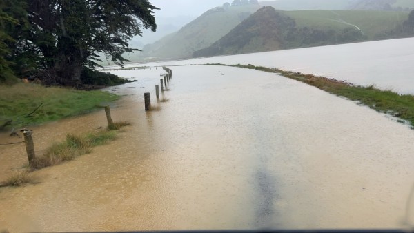
Rivers across Dunedin are rising, expected to peak at midnight / DCC
“Contractors have been checking and clearing the city’s stormwater systems, sweeping gutters and checking mud tanks in low-lying and high-risk areas in preparation for this weather event. We are working hard to ensure the city is ready and all steps are taken to minimise any impacts, and our contractors and staff are on standby to respond to any incidents.
“We are also asking any residents who notice a blocked mud tank near their home to clear debris on to the footpath if they are able to, where it will be picked up by contractors when the weather clears.
“More information will be available if required via the DCC website and DCC social media channels, as well as other media.”
ORC science and resilience general manager Tom Dyer says ORC flood response crews responsible for flood control areas including the Leith Valley, Taieri/Silverstream and the Clutha schemes area have been preparing for the weather event. They have extra contractors on standby and have opened coastal river mouths as a precaution. Pumps on these schemes are also activated.
“MetService have told us that their predictions mean Dunedin Coastal area is currently the area of most concern, and our staff will be keeping a very close eye on rivers, streams, and associated flood schemes, in this area.
“We expect all rivers across coastal and southern Otago to rise throughout the evening. Key rivers we are focused on at this stage include the Taieri River, the Silverstream, Leith Stream, the Pomahaka and Tokomairiro rivers.”
People needing information about river, stream and water flows can go to the ORC environmental data portal."
Otago Civil Defence Controller Rob West says the slow-moving and prolonged heavy rainfall is forecast to continue until late on Friday and has already prompted a Heavy Rain Warning – Red from the MetService.
“This weather system is also coming in from the east, which we know from past experience can cause flooding in parts of Dunedin when the weather system stalls and heavy rain continues in one location.
“It’s important that everyone keeps up to date with the latest information as the situation develops into this evening, including via the DCC website and social media channels.”
Video: The Taieri River at State Highway 87 between Ranfurly and Hyde at 5.00 pm October 3. Footage: Crux.
Civil Defence Minister Mark Mitchell is also on his way to Dunedin.
Motorists have been advised to stay off all Otago roads.
Peak times for the Silverstream, Leith and Lindsay rivers are around midnight tonight, with second peak tomorrow afternoon. The Clutha River at Balclutha, Pomahaka at Burkes Ford and Waitahuna River at Tweeds bridge.
In South Otago, the Tokomairiro and Pomahaka will rise to their third alarm levels but no flooding/impact is expected. The Clutha River at Balclutha may reach a peak of ~1900-2000 cumecs - slightly above the third flood warning. This is an awareness alarm with no flooding expected at this stage.
The Dunedin City Council has activated its emergency operations centre and Clutha and Waitaki are both actively monitoring.
Main image: DCC / Sandbags at the ready at the Dunedin Ice Stadium carpark, Thursday, October 3, 2024.


